
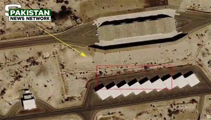
PNN – The Trump administration has prevented the release of high-resolution images of conflict zones by exerting pressure on satellites companies.
According to the report of Pakistan News Network; The New York Times has revealed that the administration of U.S. President Donald Trump has pressured commercial satellite imagery companies to refrain from publishing high-resolution images of conflict zones, particularly in the Middle East.
This move has raised concerns regarding the potential restriction of journalists, researchers, and humanitarian organizations in their ability to document the consequences of military operations and verify official U.S. accounts—particularly given that such imagery has previously helped reveal the damage caused by U.S. strikes on schools and residential homes in Iran.
In a visual report published on Wednesday titled “What Do We Lose When Satellite Images Are Blocked?” The New York Times noted that, in recent years, satellite imagery has been instrumental in documenting destruction in the Gaza Strip, mass graves in Ukraine, and an attack on a school in the Iranian city of Minab.
The report states that during the initial days of the conflict with Iran, satellite imagery revealed details regarding U.S. missile strikes on civilian targets, as well as damage sustained by American bases—damage that was more extensive than what the Trump administration had acknowledged.
According to The New York Times, Planet Labs, a major satellite imaging company, has informed its clients that it is restricting access to satellite imagery at the request of the U.S. government.
Vantor has also previously implemented similar restrictions, stating that this action was taken in accordance with the company’s internal policies.
These restrictions now encompass vast areas across the Persian Gulf, Gaza, and Lebanon—including regions where U.S. forces are not officially stationed. These measures are being implemented at a time when the companies in question remain heavily reliant on government contracts.
Meanwhile, a report by The New York Times indicates that U.S. government officials and several members of Congress have expressed concern that Iran might utilize commercial satellite imagery to pinpoint the locations of U.S. forces and target them. Such concerns have prompted Washington to pressure these companies to tighten their restrictions.
The report also mentions a tool developed in 2023 to monitor destruction in the Gaza Strip. By utilizing imagery from the European Space Agency alongside high-resolution commercial satellite imagery from the United States, this tool enabled the assessment and documentation of damage.
The New York Times has emphasized that current limitations make it difficult to identify the nature of destroyed buildings or the types of weapons employed in attacks. The newspaper has warned about the implications of such constraints for investigations into potential war crimes, the assessment of needs among displaced persons and refugees, the evaluation of safety in camps, and the monitoring of deforestation in the Amazon—a task currently supported by machine learning technology.